- Profile Jurisdictions GOV DEPARTMENTS Cultures Travelling Educate
-
【Administrative Division】Yanhe Tujia Autonomous County is located in the northeast corner of Guizhou Province, the north of Tongren City, and the lower reaches of the Wudong River. The northern and eastern parts are adjacent to Pengshui and Youyang County in Chongqing City, and the northwest is adjacent to Zunyi's Wuyuan County. Yanhe has a distinct geographical advantage, serving as a distribution center for materials in the border areas of Qian, Yu, Xiang, and E, and is known as the " gateway to Northeast Qian and a key pass of the Wudong River." It is 180 kilometers from Tongren Feng Huang Airport and 60 kilometers from the Yuxiang Railway Station. The county is well-connected by water and land, with convenient transportation and a county area of 2,483.51 square kilometers. The county governs 4 streets, 17 towns, 2 townships, 385 villagers' committees, and 61 community residents' committees. As of the end of 2024, the county had a registered population of 695,100 people, an increase of 0.20 million people over the previous year, and a permanent population of 4.085 million people, a decrease of 0.93 million people over the previous year. The ethnic minority with the largest population is the Tujia ethnic group.
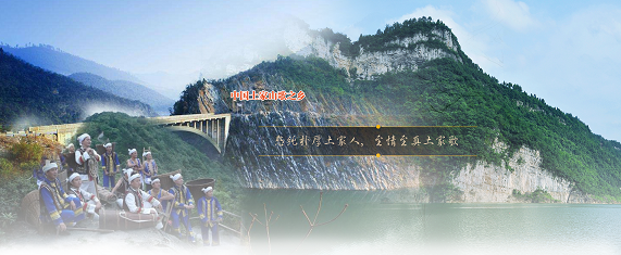
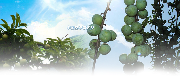
The mountains and rivers along the river are beautiful, the folk customs are simple, the history and culture are long, and the Tujia culture, red culture, and Wudong River culture complement each other. The Wudong River flows through the jurisdiction of Yanhe for 132 kilometers, combining the beauty of the magnificent, the strange, the dangerous, and the beautiful, forming a natural landscape of mountains and rivers, known as the "Wudong River Hundred-mile Gallery", which is a national scenic spot and water conservancy scenic area; the Ma Yanghe Black Leaf Mon key Nature Reserve is the habitat of the national first-class protected animal, the black leaf mon key, and a treasure house of a variety of rare animals and plants. It is the largest distribution area of the black leaf mon key in the world and a national nature reserve; the Qian Dong Revolutionary Base centered on Yanhe is one of the eight major revolutionary bases in the country, and the Qian Dong Special District Revolutionary Committee is the first red regime on the Yunnan-Guizhou Plateau, and its old site is a national key cultural relics protection unit. Yanhe is also one of the four single Tujia autonomous counties in the country, a revolutionary old district county and an open county, and is known as the hometown of Chinese Tujia mountain songs, the hometown of Chinese folk art culture, and the hometown of Chinese hollow jujube.
[Natural Geography] Yanhe Tujia Autonomous County is located between 28°12'45" and 29°05'23" north latitude and 108°03'49" and 108°37'53" east longitude, with a north-south length of 98.28 kilometers and an east-west width of 53 kilometers, accounting for 1.4% of the total area of the province and 13.7% of the total area of the region. It is located on the northeast edge of the transition from the Guizhou Plateau to the Xiangxi Hilly Land and the Sichuan Basin, at the intersection of the Dala Mountain Range and the Wuling Mountain Range. The Wudong River runs through the entire county from south to north. The terrain is high in the northwest and southeast, low in the middle, and slopes from the northwest and southeast to the central Wudong River valley. It is a narrow strip that is wider in the south and narrower in the north. The expression of the landform contour is obviously controlled by the geological structure. The landform in the county is "mountain in the axis and valley in the wings". The main mountains in the north of the county include Jinzhu Mountain, Gouni Gao to Qilao Rock Gate to Mother Pig Hill, in the northwest there are Kunlong Mountain, Nanzhuang Gao, Xuehua Gao, in the middle there are Niuxiangbao to Xuanfeng Peak to Three Rock, Dagao to Mon key Peak to Bajixi Rock, Puxi Gao, etc., which are branches of the Dala Mountain Range; in the southeast there are Zhujiayao to D木Turn to Laolin Gao to Gaohat Peak, Dashi Mountain to Guanyin Rock to Jinxingshan, Longyao, etc., which are branches of the Wuling Mountain Range. Its strike and the extension direction of the valleys and fans between them are generally in the direction of north-northeast or northeast. There are 8,815 peaks in the county, with an average of 3.6 peaks per square kilometer. Among them, there are 2,291 low mountains with an altitude of 1,000-1,500 meters, accounting for 26%; 6,059 low mountains with an altitude of 500-1,000 meters, accounting for 68.7%; 465 hills with an altitude of less than 500 meters, accounting for 5.3%. The highest point is at the confluence of Houping, Tangba Township, and Ketai Town in the northwest of the county, at the Kunlong Mountain Jiaoying Rock, with an altitude of 1,462 meters; the lowest point is at the Xiaojiangba in the northeast of the county, where the Wudong River exits, with an altitude of 225 meters. The relative height in the county is generally between 300 and 700 meters, and the two sides of the streams and rivers often reach about 1,000 meters. In the total area, 11.5% of the ground is below 500 meters in altitude, 48.4% is between 500 and 800 meters, 22.8% is between 800 and 1,000 meters, and 17.3% is above 1,000 meters; 19.3% of the ground has a slope of less than 15 degrees, 32.5% has a slope of 15-25 degrees, 31.5% has a slope of 25-35 degrees, and 16.7% has a slope of more than 35 degrees. The county is divided into two major parts, northwest and southeast, by the Wudong River. The northwest is the Dala Mountain Range and the southeast is the Wuling Mountain Range, with the terrain sloping from the northwest and southeast to the Wudong River valley. The Wudong River has one to four terraces, the first terrace is 20-25 meters above the river surface, which is a base terrace mainly composed of gravel layer, and the urban areas along the river are distributed on the upper part.The second-level terrace is 60-80 meters above the river surface, which is an eroded terrace; the third-level terrace is 80-100 meters above the water surface, distributed in the wide valley section of the Wudong River, which is an eroded terrace, with a residual thickness of not large pebble layer; the fourth-level terrace is 180-200 meters above the river surface, which is a residual old valley, mostly in the wide valley period of the topography. The terraces along the Wudong River from top to bottom are Wangpai, Houjia Tuo, Qitang, Satou, Baituo, Lianqiao, Pinghe, Juntuan, Heita, Siqu, Ma Du, Hongdu, etc. The river is located in the middle latitude, the closest distance to the ocean is 930 kilometers, and it is a region controlled by the summer monsoon atmospheric circulation, belonging to the middle subtropical monsoon humid climate type. The climate is distinct in the four seasons, with warm winters, early springs, long summers, abundant heat, sufficient water, and few sunny days. The vertical difference of the climate is obvious, with water and heat at the same time, light and temperature at the same time, and frequent occurrence of disaster weather. For every 100 meters of altitude, the average annual temperature drops by 0.56 degrees Celsius, the accumulated temperature above 10 degrees Celsius is reduced by an average of 202 degrees Celsius, the beginning of the day is delayed by 2.2-4.4 days, and the end of the day is advanced by 3-7.5 days. In areas with an altitude below 500 meters, the average annual temperature is 16.5-18 degrees Celsius, the accumulated temperature above 10 degrees Celsius is 5100-5700 degrees Celsius, lasting 250-270 days, with a warm and hot climate; in areas with an altitude of 500-800 meters, the average annual temperature is 14.9-16.5 degrees Celsius, and the main distribution of light, heat, and water resources is in the second half of the year (April-September). From April to September, the sunshine accounts for 71% of the whole year, the total solar radiation accounts for 69.1% of the whole year, and the accumulated temperature above 0 degrees Celsius accounts for 68.2% of the whole year; the precipitation accounts for 75.4% of the whole year. It is a productive climate with water and heat at the same time and light and temperature at the same time, but the precipitation is unstable, the temperature changes greatly, and droughts, low temperatures, heavy rains, hail, and strong winds often occur.The average decrease in the accumulated temperature above 10 degrees Celsius is 202 degrees Celsius, the start of the season is delayed by 2.2-4.4 days, and the end of the season is advanced by 3-7.5 days. In areas with an altitude below 500 meters, the average annual temperature is 16.5-18 degrees Celsius, the accumulated temperature above 10 degrees Celsius is 5100-5700 degrees Celsius, and it lasts for 250-270 days, with a warm and mild climate; in areas with an altitude of 500-800 meters, the average annual temperature is 14.9-16.5 degrees Celsius, and the light, heat, and water resources are mainly distributed in the second half of the year (April-September). From April to September, the sunshine accounts for 71% of the whole year, the total solar radiation accounts for 69.1% of the whole year, and the accumulated temperature above 0 degrees Celsius accounts for 68.2% of the whole year; the precipitation accounts for 75.4% of the whole year. It is a productive climate with water and heat at the same time and light and temperature at the same time, but the precipitation is unstable, the temperature changes greatly, and disasters such as drought, low temperature, heavy rain, hail, and strong wind often occur.The accumulated temperature above 10 degrees Celsius has decreased by an average of 202 degrees Celsius, the beginning of the season is delayed by 2.2-4.4 days, and the end of the season is advanced by 3-7.5 days. In areas with an altitude below 500 meters, the average annual temperature is 16.5-18 degrees Celsius, the accumulated temperature above 10 degrees Celsius is 5100-5700 degrees Celsius, and it lasts for 250-270 days, with a warm and mild climate; in areas with an altitude of 500-800 meters, the average annual temperature is 14.9-16.5 degrees Celsius, and the light, heat, and water resources are mainly distributed in the second half of the year (April-September). From April to September, the sunshine accounts for 71% of the whole year, the total solar radiation accounts for 69.1% of the whole year, and the accumulated temperature above 0 degrees Celsius accounts for 68.2% of the whole year; the precipitation accounts for 75.4% of the whole year. It is a productive climate with water and heat at the same time and light and temperature at the same time, but the precipitation is unstable, the temperature is variable, and disasters such as drought, low temperature, heavy rain, hail, and strong wind often occur.Meters; the lowest point is at Xiaobangtan, where the county's northeast border meets the Wudong River, with an altitude of 225 meters. The relative height within the county generally ranges from 300 to 700 meters, and the banks of the streams and rivers often reach about 1000 meters. In terms of area, 11.5% of the land is below 500 meters in altitude, 48.4% is between 500 and 800 meters, 22.8% is between 800 and 1000 meters, and 17.3% is above 1000 meters. The slope of the land is 19.3% less than 15 degrees, 32.5% between 15 and 25 degrees, 31.5% between 25 and 35 degrees, and 16.7% greater than 35 degrees. The county is divided into two main parts, northwest and southeast, by the Wudong River. The northwest is part of the Dala Mountain Range, while the southeast is part of the Wuling Mountain Range. The terrain slopes from the northwest and southeast towards the Wudong River valley. The Wudong River has one to four terraces. The first terrace is 20 to 25 meters above the river surface and is a base terrace dominated by gravel. The second terrace is 60 to 80 meters above the river surface and is an erosion terrace. The third terrace is 80 to 100 meters above the water surface and is distributed in the wide valley section of the Wudong River. It is an erosion terrace with a remaining thickness of not much gravel. The fourth terrace is 180 to 200 meters above the river surface and is a residual old valley, mostly from the wide valley period. The terraces along the Wudong River are named from top to bottom as Wangpai, Houjia Tuo, Qitang,沙Tuo, Baktuo, Lianqiao, Pinghe, Unity, Heita, Siqu, Ma Du, Hongdu, etc. The river bank is located in the mid-latitudes, with the shortest distance to the ocean at 930 kilometers. It is a region controlled by the summer monsoon atmospheric circulation and belongs to the mid-subtropical monsoon humid climate type. The climate is distinct in the four seasons, with warm winters, early springs, long summers, and abundant heat and moisture. It is cloudy and has little sunshine. The vertical difference of the climate is obvious, with water and heat at the same time, light and temperature at the same time, and frequent occurrence of disasterous weather. For every 100 meters of altitude, the average annual temperature drops by 0.56 degrees Celsius, the accumulated temperature above 10 degrees Celsius decreases by an average of 202 degrees Celsius, the beginning of the day is delayed by 2.2-4.4 days, and the end of the day is advanced by 3-7.5 days. In areas below 500 meters in altitude, the average annual temperature is 16.5-18 degrees Celsius, the accumulated temperature above 10 degrees Celsius is 5100-5700 degrees Celsius, and it lasts for 250-270 days. The climate is warm and hot; in areas between 500 and 800 meters in altitude, the average annual temperature is 14.9-16.5 degrees Celsius, and the main distribution of light, heat, and water resources is in the second half of the year (April-September). From April to September, the sunshine accounts for 71% of the whole year, the total solar radiation accounts for 69.1% of the whole year, and the accumulated temperature above 0 degrees Celsius accounts for 68.2% of the whole year; the precipitation accounts for 75.4% of the whole year. It is a productive climate with water and heat at the same time and light and temperature at the same time, but the precipitation is unstable.The temperature fluctuates greatly, and droughts, low temperatures, heavy rain, hail, and strong winds often occur.
[Natural Resources] The soil types in the county are zonal and non-zonal. The zonal soils mainly include yellow soil and yellow brown soil; the non-zonal soils are mainly calcareous soil, purple soil, and coastal soil. There are six soil classes, including yellow soil, yellow brown soil, calcareous soil, rice soil, purple soil, and coastal soil, 17 sub-classes, 38 soil genera, and 80 soil species. Due to frequent crustal activities, multiple sedimentation cycles have been formed in the low-lying areas on both sides of the folded uplift zone, resulting in a variety of sedimentary mineral deposits. The types of mineral deposits that have been explored include coal, fluorite, heavy barite, lead and zinc, mercury, iron, pyrite, copper, sulfur, phosphorus, manganese, gold, calcite, ice island, kaolin, bauxite, clay, gypsum, marble, quartz sand, limestone, and dolomite, among more than 20 kinds. Among them, the reserves of heavy barite are 7 million tons, the reserves of lead and zinc ore are 1.53 million tons, the reserves of iron ore are 8.71 million tons, and the reserves of Qiaojia smoke coal are 23.06 million tons. The average annual rainfall in various parts of the county is between 1080-1250 millimeters, with an average annual rainfall of 1140 millimeters in the county, and a total rainfall of 28.23 billion cubic meters. The annual runoff depth in the county is between 600-800 millimeters, with more in the north and less in the south, and more in the west and less in the east, consistent with the rainfall. The total amount of water that can be reused from the Wudong River and its tributaries, such as Houxi River, Ma蹄 River, Damao River, Baimi River, Anxi River, and Hongdu River, is 37.1 billion cubic meters, and the water energy resources are abundant. The theoretical amount of water energy is 9,786.68 million kilowatts, and 72 power stations can be built with an installed capacity of 4,170.87 million kilowatts. The rivers that can be developed for power generation with a capacity of more than 1 million watts include the Wudong River, Damao River, Baimi River, Shazizhen River, Guanzhou River, Anxi River, Maer River, Hongdu River, Tangba River, Jinxizhen River, Lanzi River, and Xiaoyuxi River, etc. The main wild plants in the county include forest plants, shrub plants, and grass plants, with 140 families, 358 genera, and 596 species of vascular plants. There are 21 rare plants. Among them, there are five first-class protected plants, including Davidia involucrata, Ginkgo biloba, Taxus wallichii, Taxus, and Alismatidae (water silk), and 11 second-class protected plants, including cycads, Taxus yunnanensis, Taiwania, Schima, Castanopsis, Cinnamomum camphora, Fokienia, beech, Eucommia, Schisandra, and Gleditsia, and seven third-class protected plants, including Coptis, Gastrodia, Magnolia, Schisandra glabra, Nanmu, Polygonum, and Taiwania. The county is rich in wildlife, with 85 families and 309 species of vertebrates, and 2 families, 3 genera, and 19 species of aquatic invertebrates. There are 28 rare animals in the county. Among them, there are six first-class protected animals, including black leaf mon key, leopard, white-crowned long-tailed pheasant, takin, Tibetan antelope, and goral.二级 protected animals include the macaque, pangolin, otter, musk deer, red-crowned crane, black bear, large ferret badger, small ferret badger, wolf, goshawk, sparrowhawk, pine sparrowhawk, common buzzard, eagle owl, white-tailed sea eagle, magpie sea eagle, red-footed falcon, red falcon, yellow-footed fish eagle, grass fish eagle, whooper swan, great salamander, Chinese pearl grass carp, long-eared owl, mandarin duck, etc. 25 species.
【Tourist Resources】Mainly include Tujia folk culture, historical cultural relics and scenic spots, Wudong River culture, red culture, and natural scenery, etc. The scenic tourist spots mainly include the National Scenic Spot of Wudong River Canyon, the National Nature Reserve of Maoyanghe, the natural scenic area of Ba Wang Valley; the famous scenic spots of mountains and rocks in the county, such as Maoshan, Zunaoyan, Heishui Stone Forest, etc.; there are karst caves such as Zhujiadong, Sanyingdong, Yuhe Cave, Houwuzidong, Zhongnan Cave Group, etc.; there are water scenic spots such as Guanzhou Reservoir, Baoyuan Reservoir, Xiaokou Reservoir, and water scenic spots such as Gaoyue Hot Spring, Wangtuo Hot Spring, Dahaba Hot Spring, etc.; there are new rural tourism demonstration villages such as Shazhai South Village, Shierpan, Siquan Houduping, Zhongjie Luojiazhai, Heishui Jianquan Village, etc. The main red cultural tourism resources include the former site of the Qidong Special District Revolutionary Committee, the former site of the first Soviet workers' and peasants' Congress of Qidong Special District, the grave of the Soviet Red Army in Jiaogeng Luofu, the Red Army Crossing Square, the graves of the martyrs of the Red Army, such as Prince Long, Chen Qiming, Zhang Honggu, Dai Fuqian, Li Zilan, etc., the graves of the martyrs Gong Weiqing, Yang Dianyuan, Wang Guoming, Lan Fuqing, Hou Zhaifang, etc., the monument to the deputy general officer of the Red Army, Tang Yongshou, the monument to the People's Liberation Army martyrs in Houping, the monument to the People's Liberation Army martyrs in Huangtu, etc. Tujia folk culture and tourism resources include traditional festivals such as Gankan, Niu Wang Festival, June Sixth, etc.; there are customs such as clothing, housing, food, marriage, funerals, and ceremonies; there are beliefs such as worshipping ancestors, offering sacrifices to the King of the Earth, believing in the Earth Teacher, chasing the White Tiger, respecting the White Tiger, Blue Dragon, Zhu Que, Xuanwu, etc.; there are Tujia dances such as the hand-clapping dance, Nuo drama, bride-price songs, wedding songs, meat lotus, etc.; there are ethnic crafts such as Tujia brocade, wood and stone carving, rattan and bamboo grass weaving, paper-cutting, tree bark pile painting, incense and candle making, etc.; there are ethnic dwellings such as the Tujia hanging houses in Liyu Pool, Qitancheng, and the firewalls in Heping Town. Historical cultural tourism resources include ancient tombs, ancient towns and villages, ancient pottery kilns, ancient waterways, cliff carvings, ancient cities and scenic spots, temples and monasteries, and important historical sites in modern times, etc. The main scenic spots include the Wudong Rock Ujiong River洪Peak Stone Carving Mark (Qing Dynasty), the Hongdu West Han Dynasty Pottery Kiln, the Hongdu Eastern Han Dynasty Tomb Group, the Longquan Kiln of the Northern and Southern Dynasties, the Wen Chang Pavilion, the Huizhan Pavilion, the Xu Zhengming Monument, etc.; there are the head of the Tang City, Hongdu County, He Ye Ping, the ancient city of the Sui Stone Horse, the old county government of Houping, etc.; there are the ancient town of Qitancheng, the old fortress of Guanzhou, the Siquan Liyu Pool, the Zhongzha characteristic dwellings, etc.; there are the Mawang Cave and its "Shocking Waves of the River" cliff carvings, the Wudong River ancient waterways, the "Dragon Head Rock" cliff carvings, the "Wudong Rock" cliff carvings, etc.
contact details
Tel:00-86-0856—8220913
Address:Intersection of Liaoyuan Street and Unity Avenue, Unity Street, Yanhe County
Working hours:Monday to Friday, 8:30 a.m. - 12:00 p.m.; 14:30 p.m. - 18:00 p.m., (except legal holidays)